 |
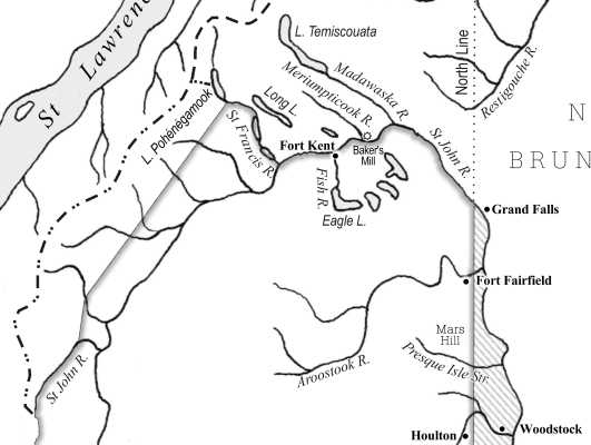
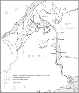
Map for '"Red Lines on Maps" Revisited: The Role of Maps in Negotiating and Defending the 1842 Webster-Ashburton Treaty' by John P. Dunbabin. (Imago Mundi 63:1, 2011) |
 |
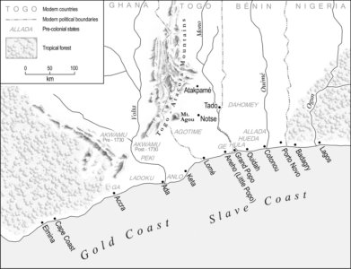
Map for 'AFRO-EUROPEAN TRADE IN THE
ATLANTIC WORLD: The Western Slave Coast, c. 1550- c. 1885' by Silke Strickrodt. (James Currey 2015) |
 |
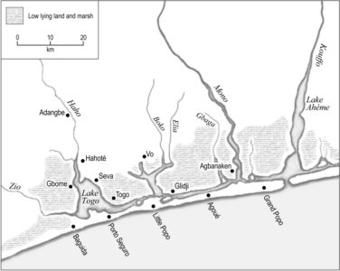
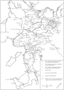
Map for 'AFRO-EUROPEAN TRADE IN THE
ATLANTIC WORLD: The Western Slave Coast, c. 1550- c. 1885' by Silke Strickrodt. (James Currey 2015) |
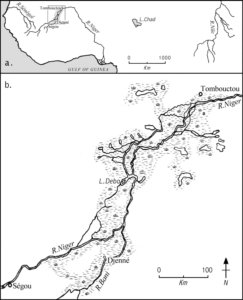 |
Map for 'The Patterns and Meaning of a Great Lake in West Africa by Gerald J. Rizzo. (Imago Mundi 58:1, 2006) |
 |
Map for 'The Ebstorf Mappamundi and Gervase of Tilbury: The Controversy Revisited' by Armin Wolf. (Imago Mundi, 64:1, 2012) |
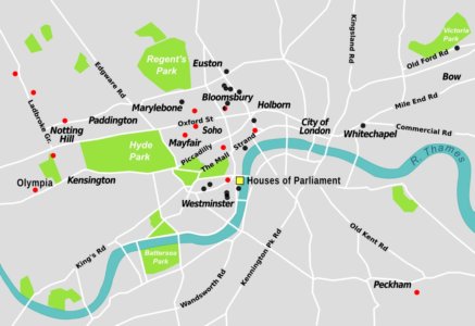 |
Map drawn for Lynne Walker and Elizabeth Darling, showing London addresses important to the Women's movement in the first half of the 20th century. (For lecture slide) |
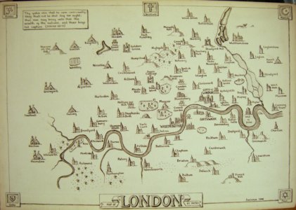 |
Faith Map of London |
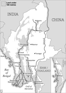 |
Map for 'Burma's Economy in the Twentieth Century' by Ian Brown. (Cambridge University Press 2013) |
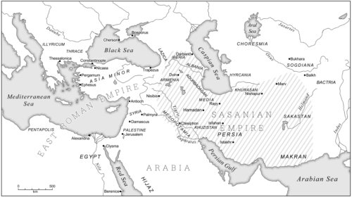 |
Map for 'The Late Sasanian Army' by James Howard-Johnston; From 'Late Antiquity: Eastern Perspectives'
edited by Teresa Bernheimer and Adam Silverstein. (The Gibb Memorial Trust 2012) |
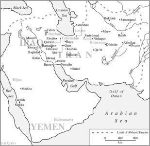 |
Map for 'The 'Alids: The First Family of Islam, 750-1200' By Teresa Bernheimer. (Edinburgh University Press, 2013) |
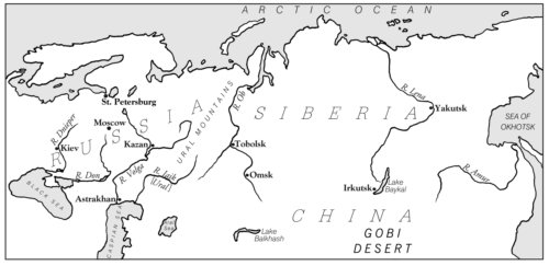 |
Map for 'Cartography, autocracy and state powerlessness: The uses of maps in early modern Russia' by Valerie A. Kivelson. (Imago Mundi, 51:1, 1999) |
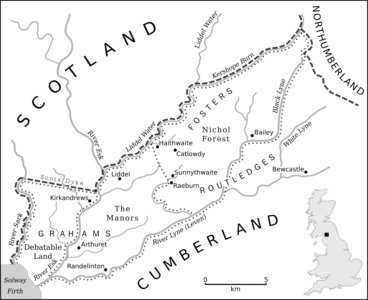 |
Map for 'Christopher Saxton's Last Maps: Nichol Forest and the Debatable Land, 1607' by William D. Shannon. (Imago Mundi, 68:1, 2016) |
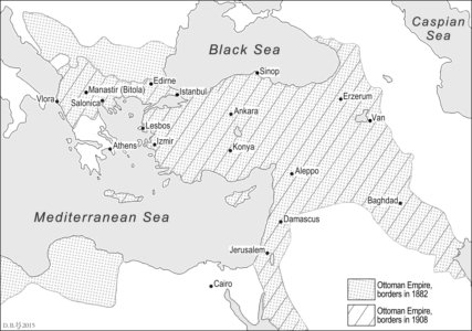 |
Map of Late Ottoman Empire for Philipp Wirtz (yet to be published) |